The first heatwave in what is called a monsoon heat-burst peaks this weekend along with a slight increase in monsoon moisture and a high fire start risk from dry thunderstorms. Additional moisture arrives after the 16th but for all the details, read on …
Join the Facebook Page for Further Updates If You Have Not Yet!
ARIZONA WEATHER FORCE MAIN:
First, I’ll start out with the current heatwave situation. On June 2nd, a week ago (click here) AZWF grids had issued a Special Weather Statement for such with two articles. Those article links are below in the credit section. We will peak the heatwave across the low terrain tomorrow and into the weekend. This is already known so we’ll move into the monsoon moisture.
An increase in moisture for the southeast half of Arizona has prompted the Arizona Weather Force Thunderstorm Watch alert today for gusty downburst winds and blowing dust from outflow boundaries. This went over the e-mail alert system yesterday (click here) so if you are not on it, you should be. Click here to join it.
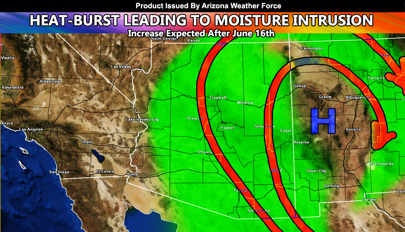
Monsoon moisture will stream northward for Friday, opening up the window of high-based thunderstorms along the Mogollon Rim from Prescott/Flagstaff/Sedona/Payson and Mt. Baldy. This is where the Arizona Weather Force Fire Weather Warning is now in effect for thunderstorms that will give the high chance at producing little rainfall, but enough lightning to spark forest fires. This is the day fire agencies need to keep an eye on. June tends to be the dry thunderstorm month, so this is not unusual, but it bodes well to continue watching this day..
On Saturday, a trough starts to take over California, which would push monsoon moisture up into all of Navajo and Apache Counties for the increase in thunderstorm chances up there. Again, dry thunderstorms risks will also be this day for those areas.
On Sunday we see a decrease in moisture across the state as the trough over California pushes the moisture back into New Mexico.
We calm down for a bit, but after June 16th, we see the ridge rebound and there is a good chance a stronger moisture push into the state will happen after then for several days. Now this isn’t a flood issue for majority, my numbers do show higher instability in the southeast of the state, which means that severe thunderstorms would then be possible with damaging winds large hail, and higher flood risks.
This was a follow-up to the following articles – You can read them and see how this forecast is evolving from Day 1.
June 2, 2022
First Major Heatwave to Hit Arizona Low Terrain After June 8th with Major Ridge of High Pressure
June 3, 2022
Long Range Heat Maps And Heat Model Activated For Members For Second Week for June 2022
Want these delivered to your e-mail and also the many other alerts for your area that area custom forecast for that you won’t see elsewhere? Sign-up for your free community paid for memberships for this season by going to this link – follow the terms of service directions as well – – https://arizonaweatherforce.com/?/register/BKNmp3
TWITTER: Join the AZWF Twitter For Articles By Clicking Here