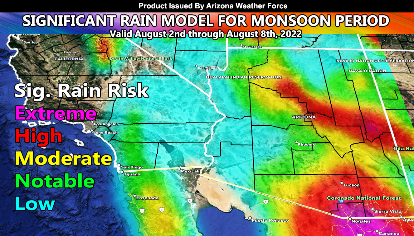
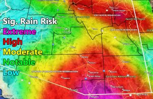
Arizona Weather Force has issued the official Long-Range Weather Advisory effective between August 2nd and August 8th for significant rainfall and severe thunderstorms across the state so read on for details and see the models …
Join the Facebook Page for Further Updates If You Have Not Yet!
ARIZONA WEATHER FORCE MAIN:
August is just getting started and while we are in a break today for the most part for widespread storm coverage, after August 3rd we ramp up once again with storms moving off the high terrain into the lower populated zones.
Deep-layer moisture will be available through this period. In situations such as this, similar to last year, damaging winds, large hail, chance of tornadoes, and major flooding will all be happening.
If you live in an RV especially, I will be giving the forecast updates on which way to park. You want to park where the straight-line winds will be coming from. You do not want to park with the side of your vehicle being vulnerable to tip you over. The front of your RV is the best defense to keep you stable. Again, I will have which way to park them in each update as the event nears. If storms come from the northeast, you park facing northeast and so on.
The Arizona Weather Force Significant Rainfall Model in the long range is posted below. You also can see it in the community section GPS model tab. Follow directions below for that.
Members: Click Here to enter the member section to see this via the GPS feature.
This was a follow-up to the following articles – You can read them and see how this forecast is evolving from Day 1.
Want these delivered to your e-mail and also the many other alerts for your area that area custom forecast for that you won’t see elsewhere? Sign-up for your free community paid for memberships for this season by going to this link – follow the terms of service directions as well – – https://arizonaweatherforce.com/?/register/BKNmp3
TWITTER: Join the AZWF Twitter For Articles By Clicking Here

