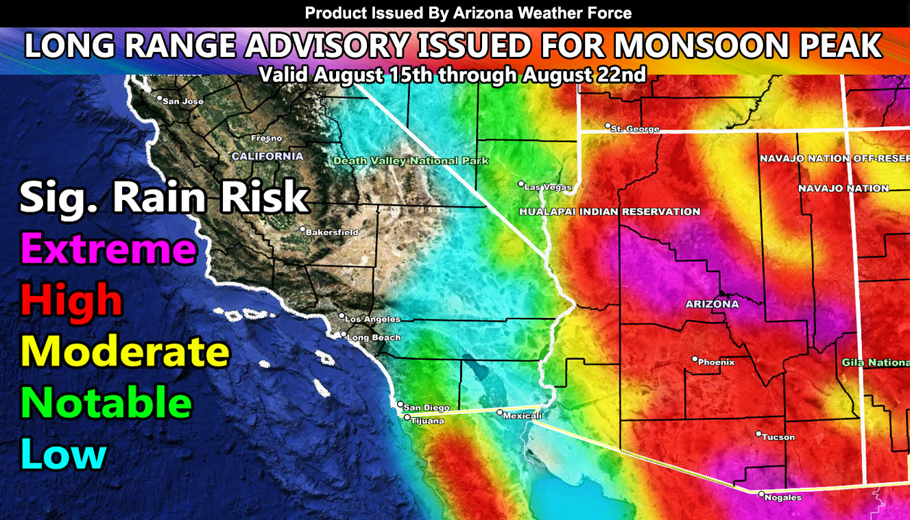
Arizona Weather Force has issued the official Long-Range Weather Advisory and Significant Rainfall Model update effective between August 15th and August 22nd for significant rainfall and severe thunderstorms across the state as the 2022 Arizona Monsoon will come to a peak so read on for details and see the models …
Join the Facebook Page for Further Updates If You Have Not Yet!
ARIZONA WEATHER FORCE MAIN:
It’ll be a bit quieter across most of the area, but storms will still be kicking across the state for the first half of this week. Around Wednesday and onward through the rest of the week and into the weekend is when we will see an easterly wave in the area. This will make the peak period of the 2022 Arizona Monsoon as low pressure tends to not suppress the storms and make them come off the higher terrain more.
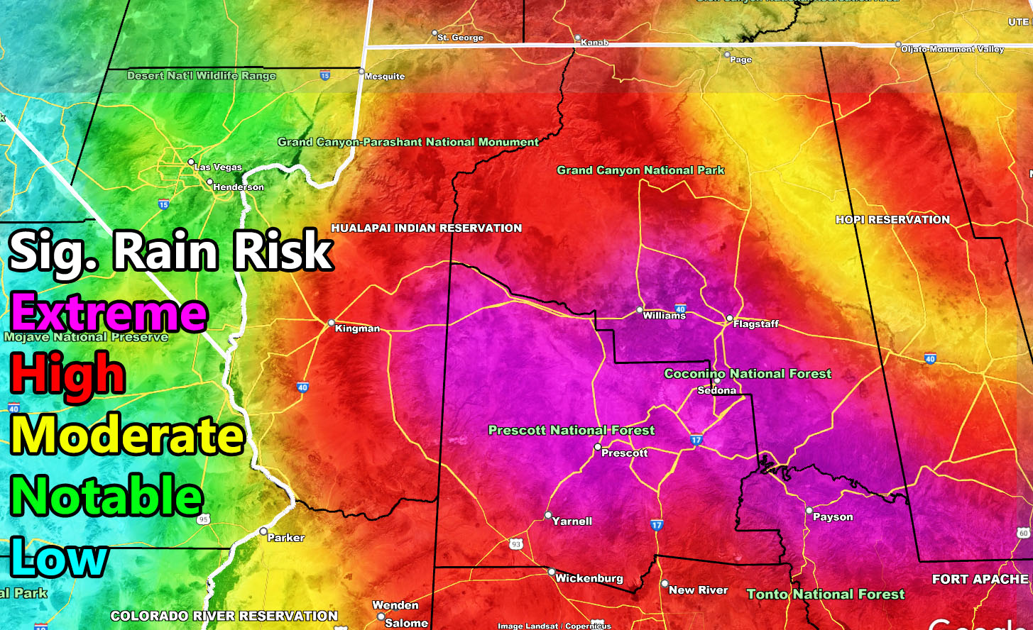
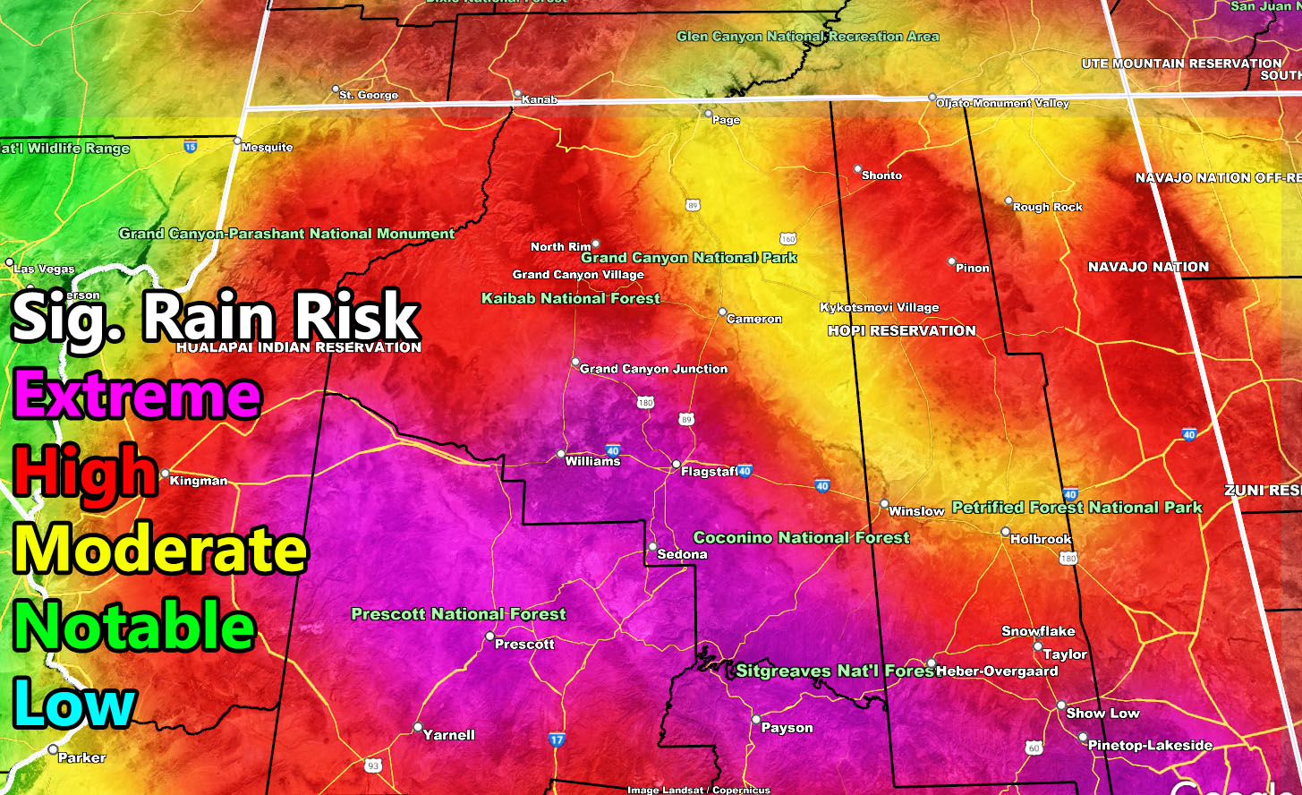
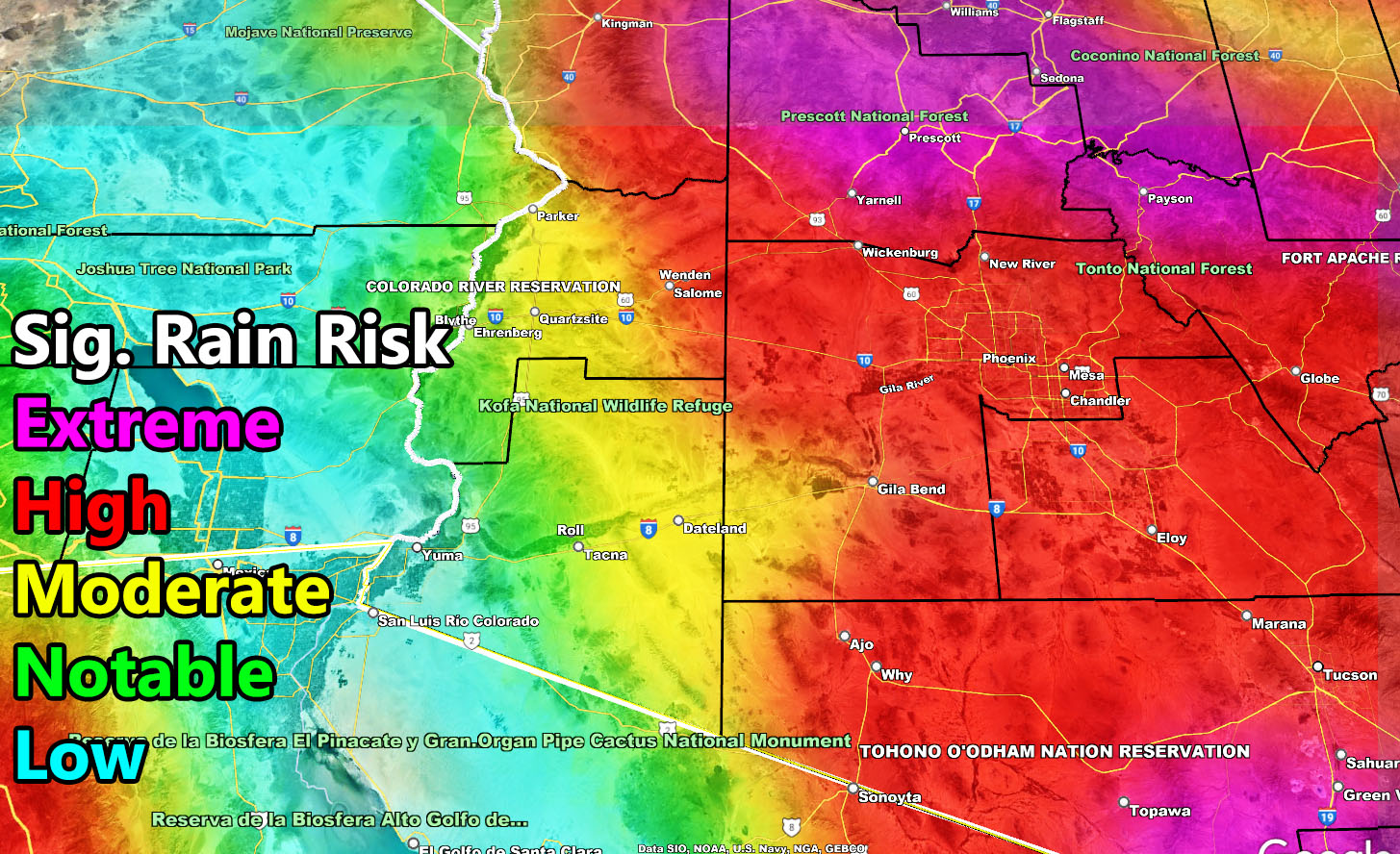
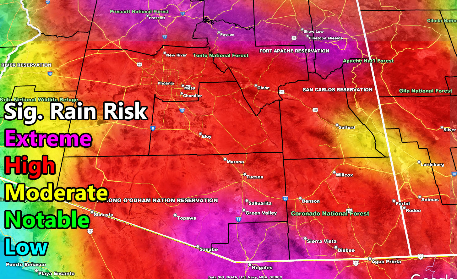
Arizona Weather Force models indicate that the metros will have the highest risk out of the entire season thus far, again, making this a very dangerous period where numerous storms with major flooding will hit all metro areas. The Rim will have Extreme Significant Rainfall risks during this period and Phoenix, Pinal, and the Tucson forecast areas will have high risk, whereas this summer thus far the AZWF model has had those areas below that. What that means is, we will have the peak during this period, a period of 5-7 days starting Wednesday August 17th, 2022, so make sure you have your preparations in place.
LONG RANGE SEPTEMBER 2022 – This is when things will start to get either ‘boring’ or interesting. September tends to relax the Northern Jet Stream, and this will bring low pressure systems further toward the California coast. As this happens, any hurricanes and/or moisture south of the region west of Baja, Mexico will be sucked northward and if intact, it would deliver more rainfall. I however do not consider it a monsoon pattern as that pattern comes from the southeast and east, not southwest. Things could get interesting if this is the year for it. A year like 2019 when Arizona Weather Force was born would mean severe thunderstorms and tornadoes in a dynamic form, non-monsoon related.
If you live in an RV especially, I will be giving the forecast updates on which way to park. You want to park where the straight-line winds will be coming from. You do not want to park with the side of your vehicle being vulnerable to tip you over. The front of your RV is the best defense to keep you stable. Again, I will have which way to park them in each update as the event nears. If storms come from the northeast, you park facing northeast and so on.
The Arizona Weather Force Significant Rainfall Model in the long range is posted below. You also can see it in the community section GPS model tab. Follow directions below for that.
Members: Click Here to enter the member section to see this via the GPS feature.
This was a follow-up to the following articles – You can read them and see how this forecast is evolving from Day 1.
Want these delivered to your e-mail and also the many other alerts for your area that area custom forecast for that you won’t see elsewhere? Sign-up for your free community paid for memberships for this season by going to this link – follow the terms of service directions as well – – https://arizonaweatherforce.com/?/register/BKNmp3
TWITTER: Join the AZWF Twitter For Articles By Clicking Here