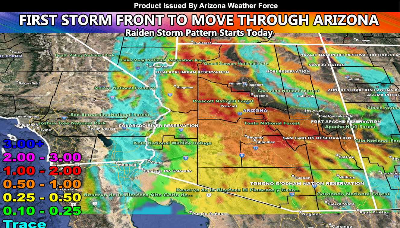
The first storm front out of a series of them will move into Arizona today, first starting across Northwest State this evening, spreading south and east into the metros by early Wednesday morning with heavy rainfall and mountain snow, continuing on and off over the afternoon, evening, and night on Wednesday so read on for details …
WANT THESE DELIVERED WITH ALL THOSE PERKS INCLUDING BEING ON THE MICRO-CLIMATE ALERT SYSTEM AND MODELS DURING EVENTS BECAUSE NOT EVERY ALERT IS POSTED ON SOCIAL MEDIA FROM THIS WEATHER OFFICE – JOIN TODAY BY CLICKING HERE – Arizona Weather Force Fundraiser and Subscriber System – Arizona Weather Force
Join the Facebook Page for Further Updates If You Have Not Yet!
ARIZONA WEATHER FORCE MAIN:
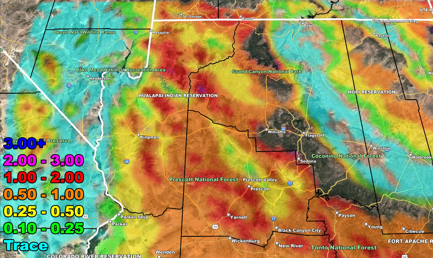
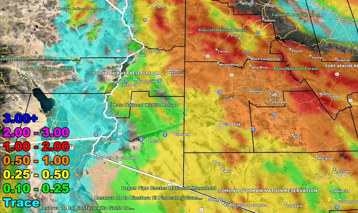
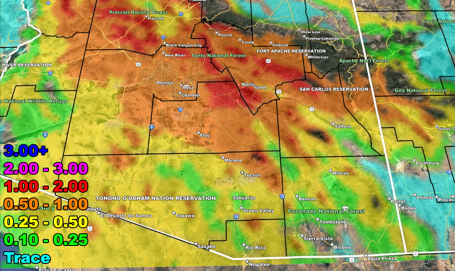
Rainfall amounts will be highest south and west of the higher terrain. 1-2″ in areas like Prescott, Payson, and Sedona. A large swath of heavy rain will develop within the upper divergent sector of a strong 200 mph jet stream for the Phoenix Metro zones, southward through the population centers of the San Tan Valley early Wednesday morning.
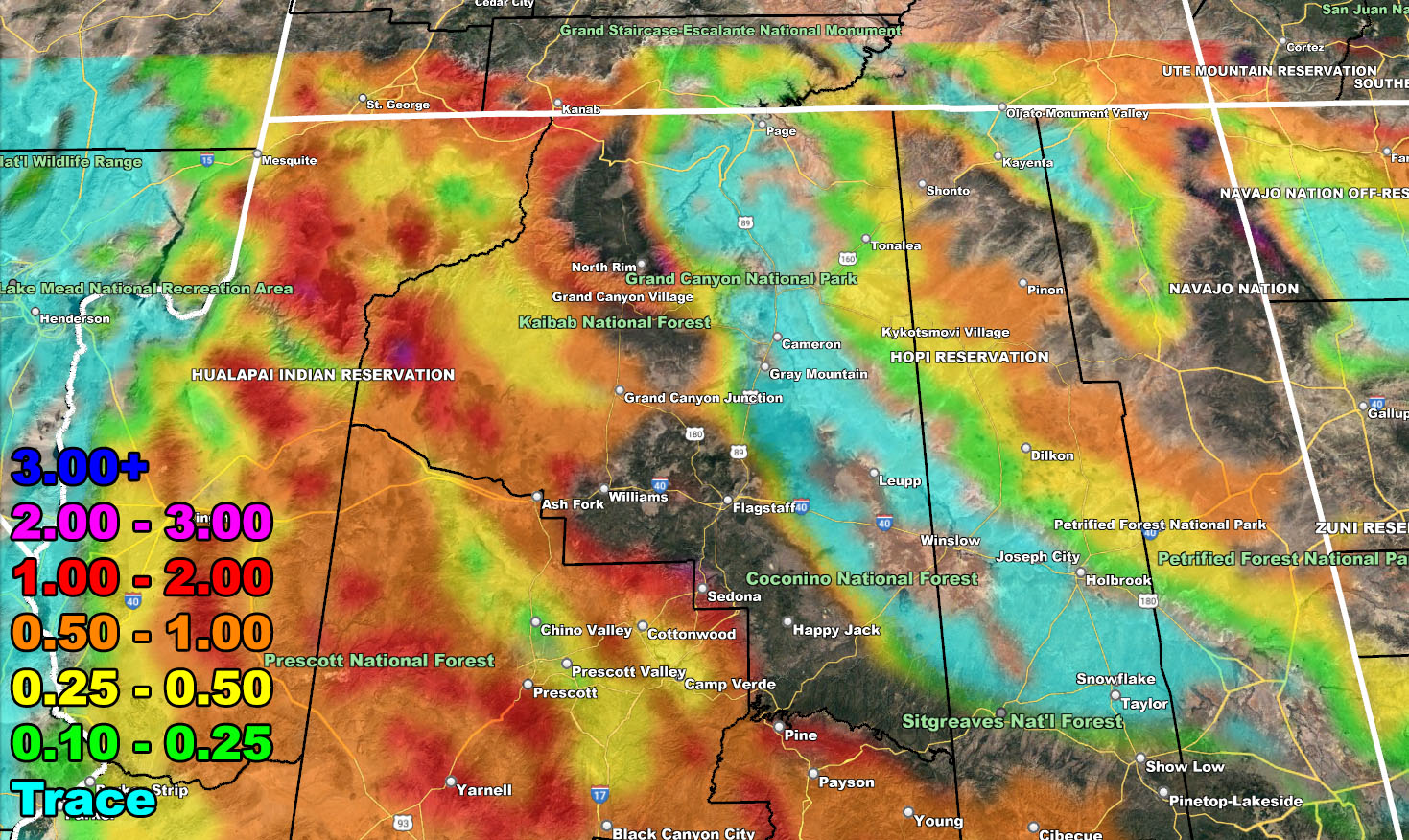
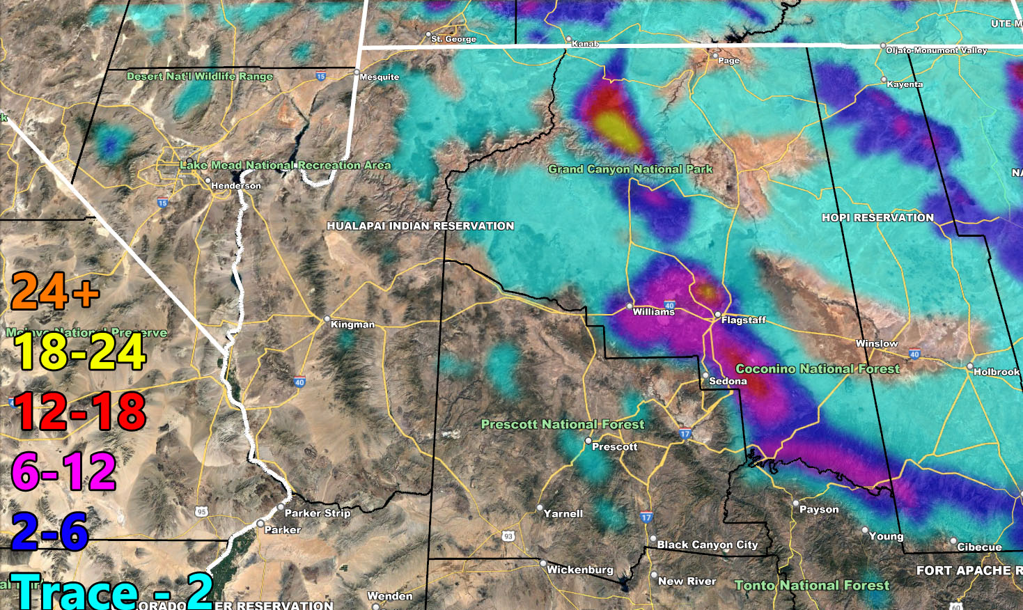
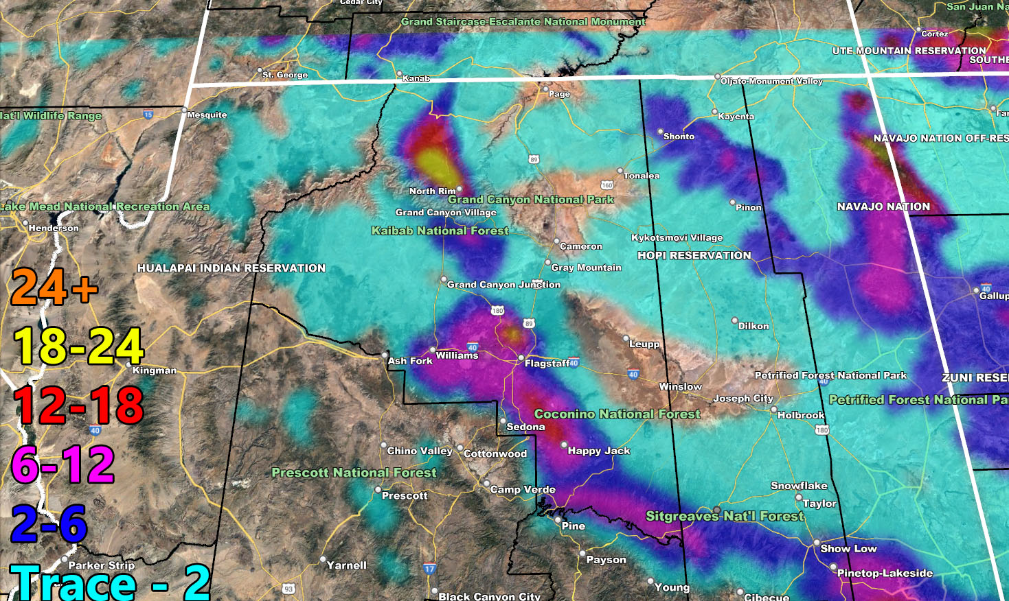
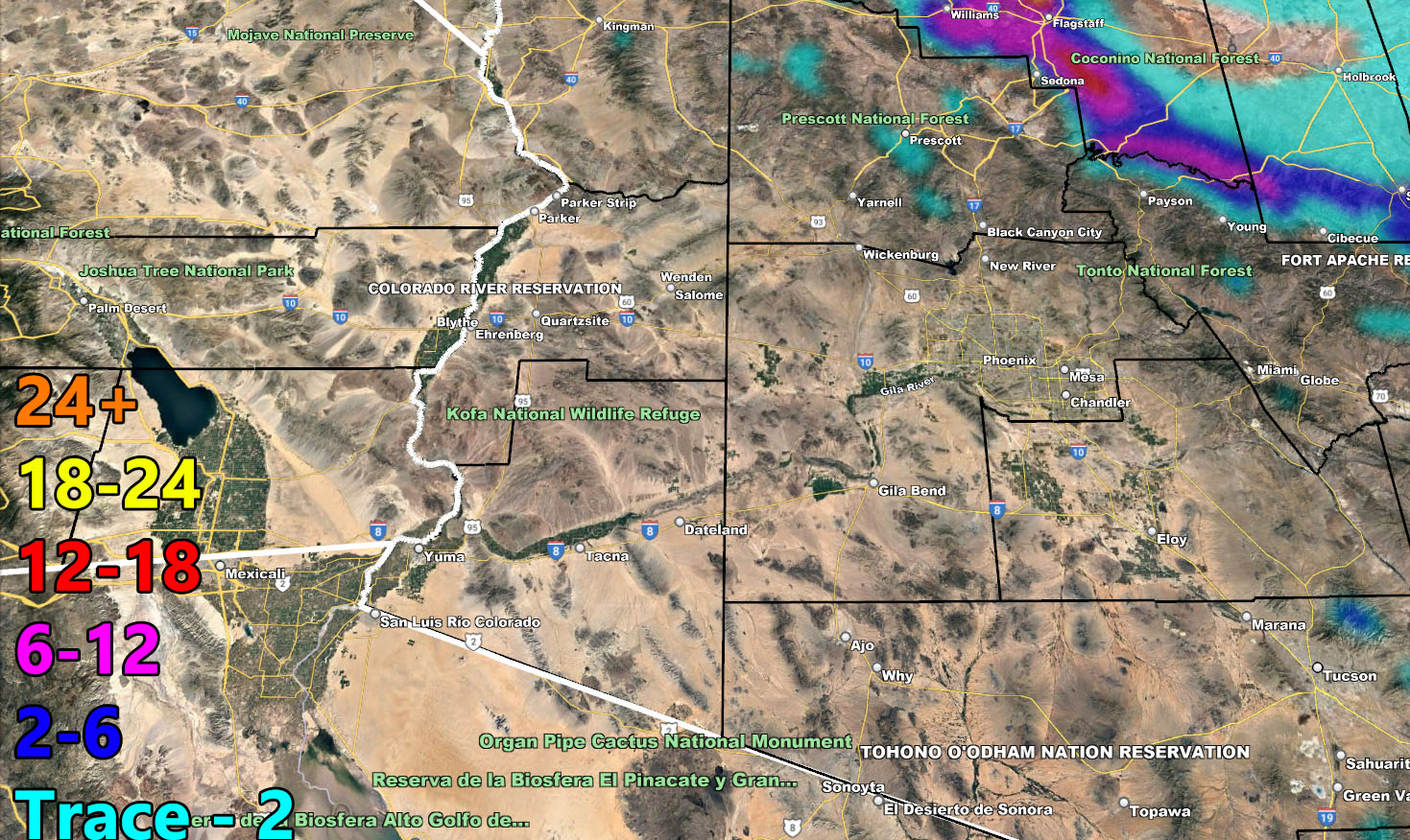
Snow-levels will be higher with this system than the previous system early this month, giving no accumulating snow to Payson, but enough levels for Flagstaff with 6-12″, a foot for Happy Jack, 2-6″ for Show Low, 4-8″ in Pinetop, and 12-18 for the upper elevations of Mt. Baldy.
Another system moves through on Thursday, followed by a larger one on New Years Day.
LONG RANGE: Unsettled weather will be off and on through the first half of January. Additional articles will be written as numbers are crunched.
Here is the rain and snow forecast for this first front.
Rain Model – VALID TONIGHT THROUGH THURSDAY 12-27 – 12-29-2022
SUPPORTING MEMBERS: Click Here To See The GPS Version Of This Model In Your Member Section Tab.
Snow Model – VALID TONIGHT THROUGH THURSDAY 12-27 – 12-29-2022
SUPPORTING MEMBERS: Click Here To See The GPS Version Of This Model In Your Member Section Tab.

WANT THESE DELIVERED WITH ALL THOSE PERKS INCLUDING BEING ON THE MICRO-CLIMATE ALERT SYSTEM AND MODELS DURING EVENTS BECAUSE NOT EVERY ALERT IS POSTED ON SOCIAL MEDIA FROM THIS WEATHER OFFICE – JOIN TODAY BY CLICKING HERE – Arizona Weather Force Fundraiser and Subscriber System – Arizona Weather Force
TWITTER: Join the AZWF Twitter For Articles By Clicking Here
Join The Main Arizona Weather Force Facebook Group (50 percent delivery time of micro-climate alerts not posted on the main AZWF page) – You can join the main AZWF page as well through that group.
Click Here To Join The Page Today