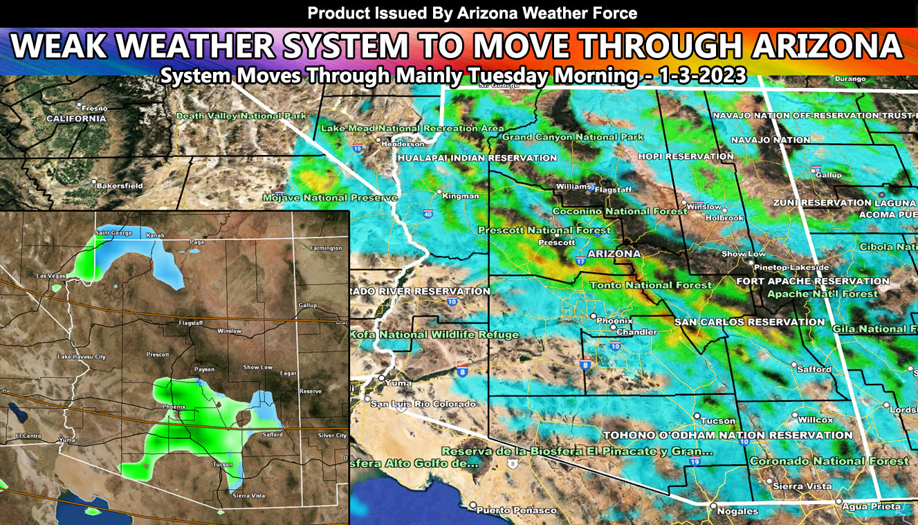
A weather system out of California will move through Arizona, separate from the residual showers that are happening now. This will maximize on Tuesday evening for some more rain and mountain snow. It will depend where you are in the upslope regions on what you will see so read on for details and see the AZWF models for rain and snow …
WANT THESE DELIVERED WITH ALL THOSE PERKS INCLUDING BEING ON THE MICRO-CLIMATE ALERT SYSTEM AND MODELS DURING EVENTS BECAUSE NOT EVERY ALERT IS POSTED ON SOCIAL MEDIA FROM THIS WEATHER OFFICE – JOIN TODAY BY CLICKING HERE – Arizona Weather Force Fundraiser and Subscriber System – Arizona Weather Force
Join the Facebook Page for Further Updates If You Have Not Yet!
ARIZONA WEATHER FORCE MAIN:
Arizona Weather Force models are indicating that this weather system, now off the Southern California coast, will move through the state on Tuesday morning. This will bring a slick ride to the metro areas, but nothing like the previous system. This system will bring more mountain snow. It will not bring gusty winds to the low terrain, but along the Mogollon Rim we will see gusts over 30+ mph at times.
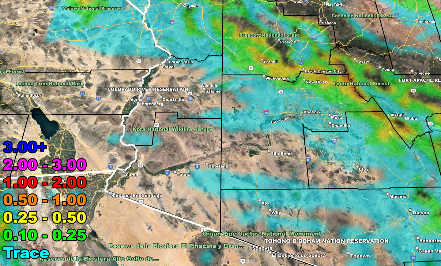
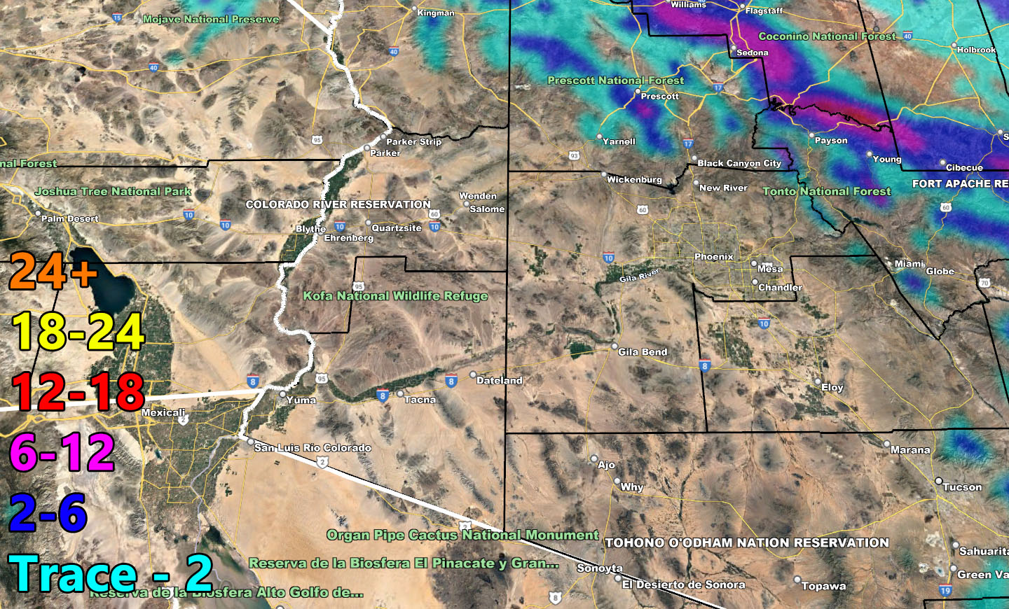
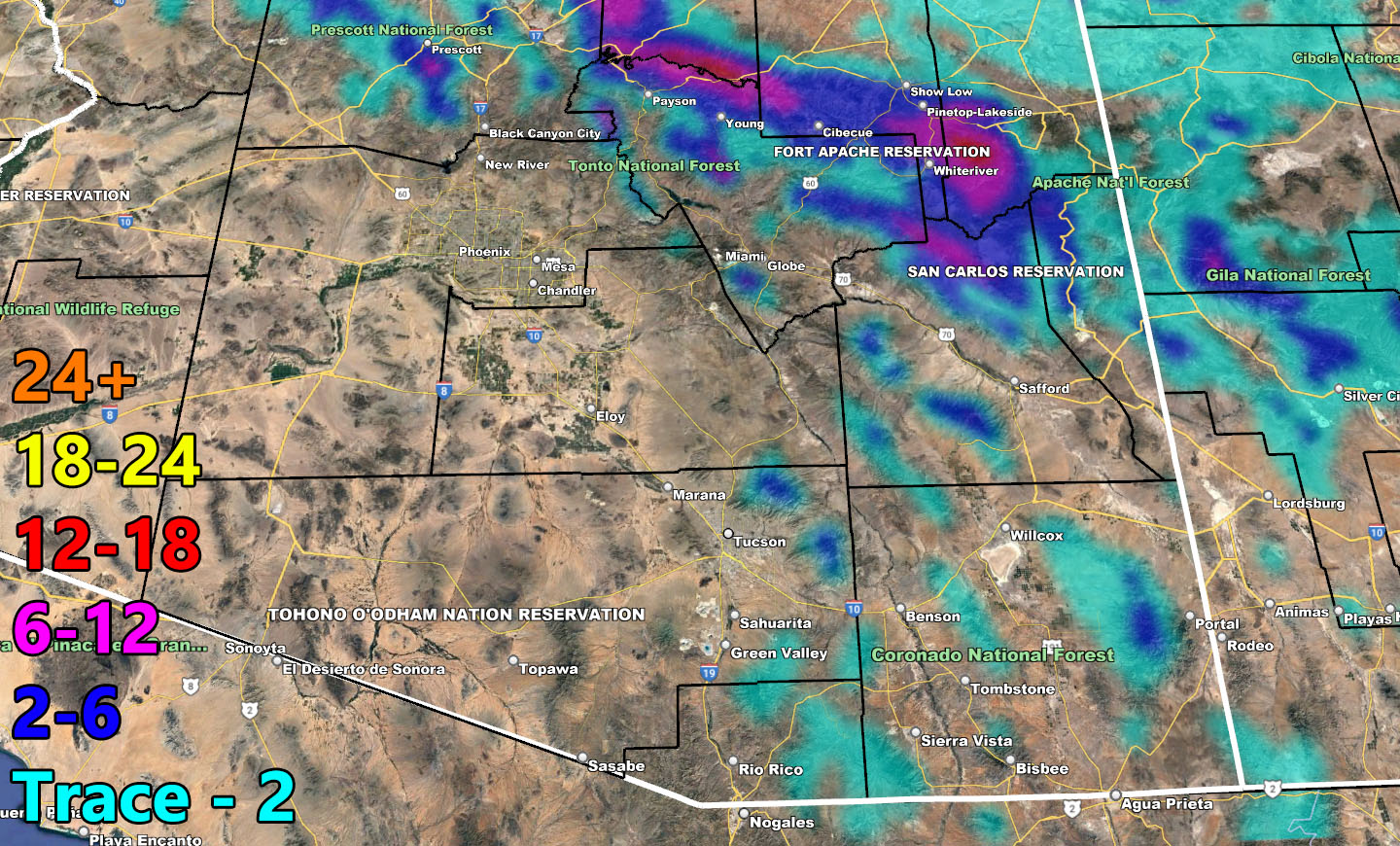
The type of system this is will be one where upsloping will matter. Upsloping means that the closer you are to the south and west of the mountains, the better your precipitation amounts will be. The example is New River at 0.25″ – 0.50″ on the Arizona Weather Force model projection and a bit south of there in Downtown Phoenix at a trace. It will matter where you are for what amounts do happen. Tucson is only in a trace as well, so do not expect much down there at all. You can go along about your day.
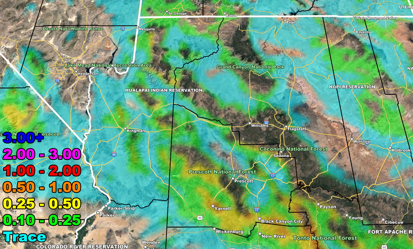
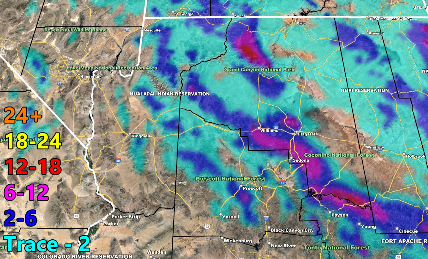
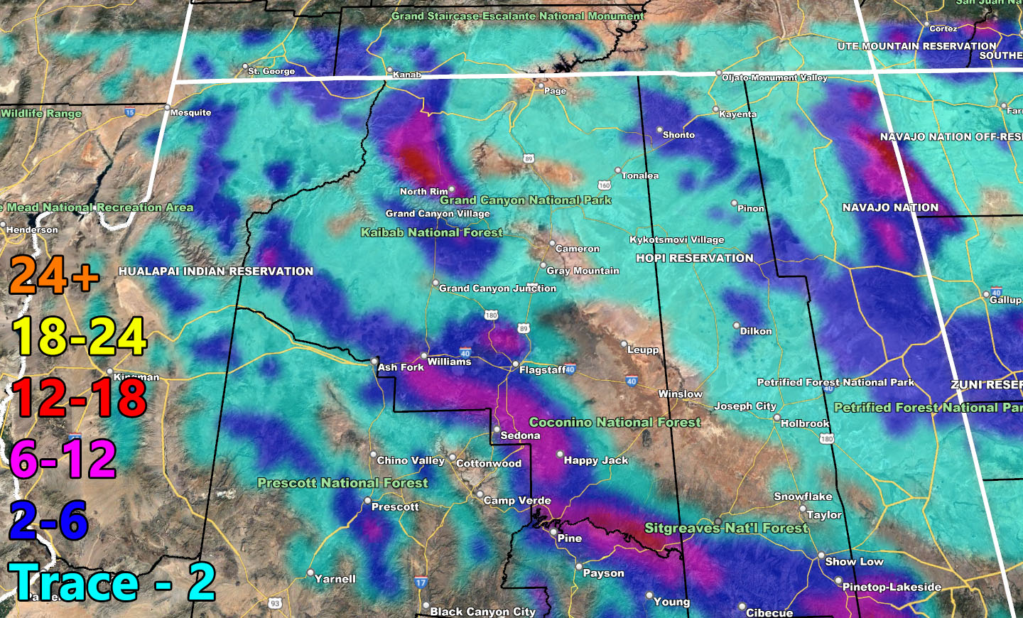
As for the mountain areas; Arizona Weather Force models are very accurate to the mile. You can note that Chino Valley has nothing, and Prescott is split between a dusting in the Yavapai Hills zone to 2-6″ in the Downtown Prescott zone and Mt. Union at 6-12″. Furthermore, Flagstaff is going to also be split with northeast of there a dusting in Doney Park, where central city gets 2-6″, and south of there along I-17 in the upsloping zone getting 6-12″. The city of Williams will see 6-12″ of snowfall with this due to being in the upsloping convergence section of this system. I can go on, but you can use the Arizona Weather Force rain and snow maps for your area, provided information is below.
LONG RANGE: We will be taking a break in the metro areas after this system, so those of you that want to dry out will get that chance. The next chance is after this weekend, mainly this next week. A good six days of no hazards until then.
Rain Model – VALID MAINLY TUESDAY
SUPPORTING MEMBERS: Click Here To See The GPS Version Of This Model In Your Member Section Tab.

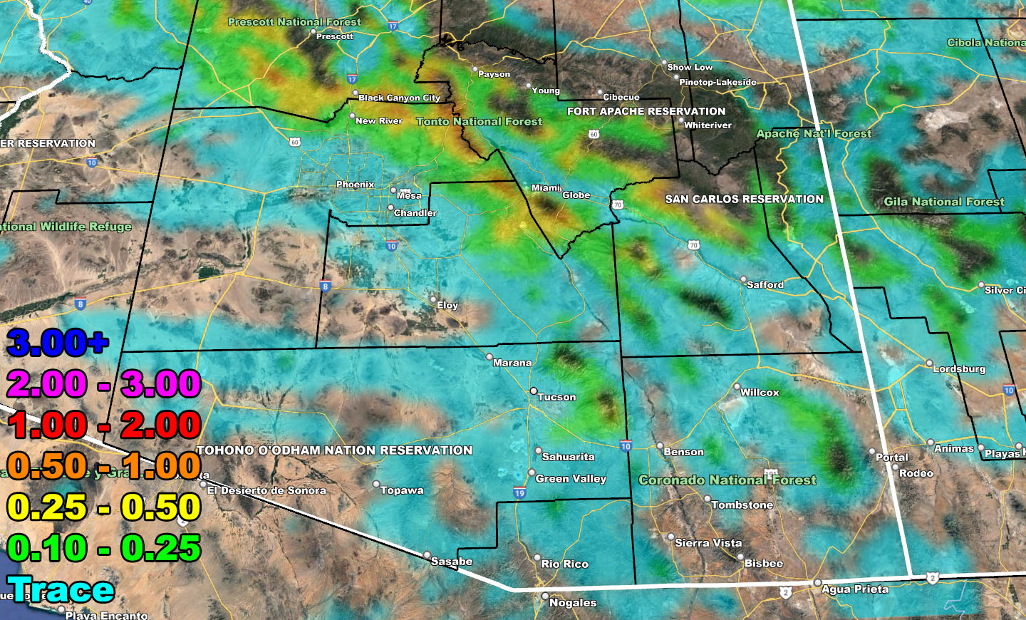
Snow Model – VALID MAINLY TUESDAY
SUPPORTING MEMBERS: Click Here To See The GPS Version Of This Model In Your Member Section Tab.
WANT THESE DELIVERED WITH ALL THOSE PERKS INCLUDING BEING ON THE MICRO-CLIMATE ALERT SYSTEM AND MODELS DURING EVENTS BECAUSE NOT EVERY ALERT IS POSTED ON SOCIAL MEDIA FROM THIS WEATHER OFFICE – JOIN TODAY BY CLICKING HERE – Arizona Weather Force Fundraiser and Subscriber System – Arizona Weather Force
TWITTER: Join the AZWF Twitter For Articles By Clicking Here
Join The Main Arizona Weather Force Facebook Group (50 percent delivery time of micro-climate alerts not posted on the main AZWF page) – You can join the main AZWF page as well through that group.
Click Here To Join The Page Today