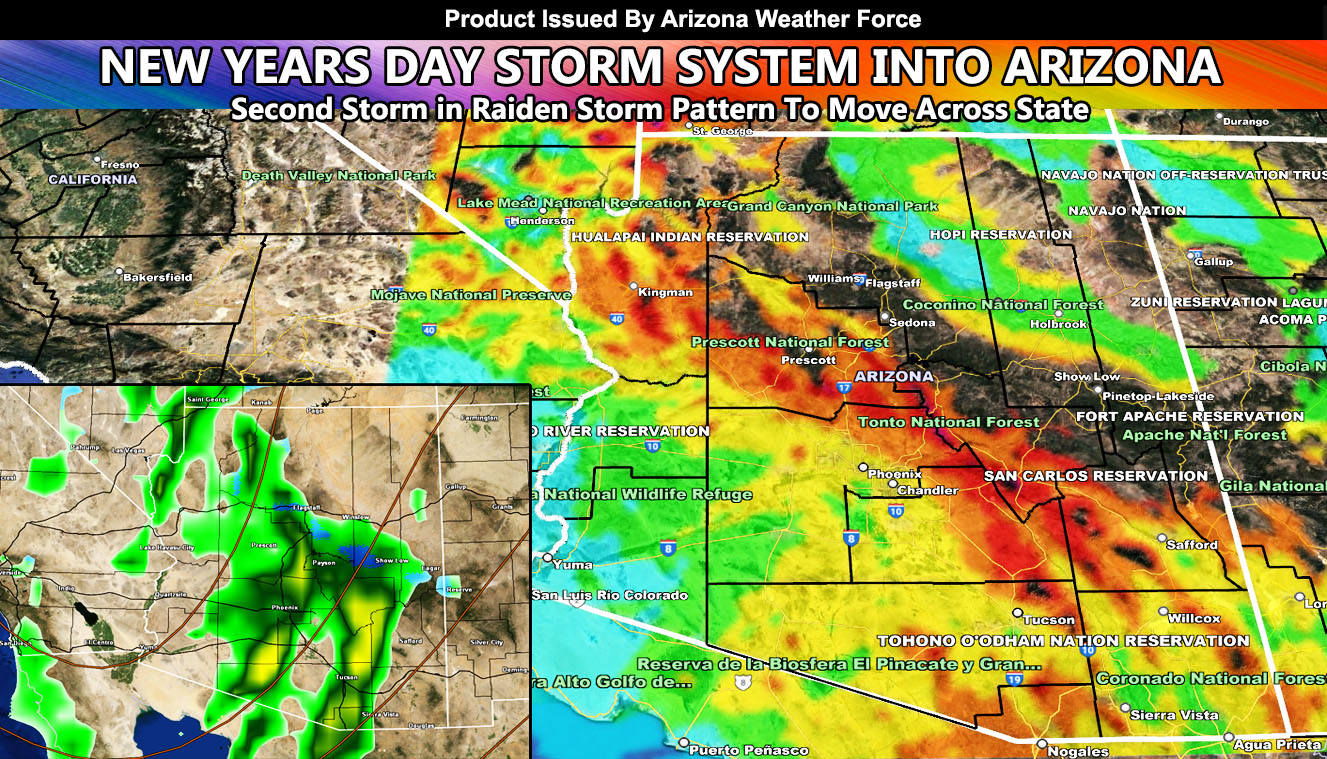
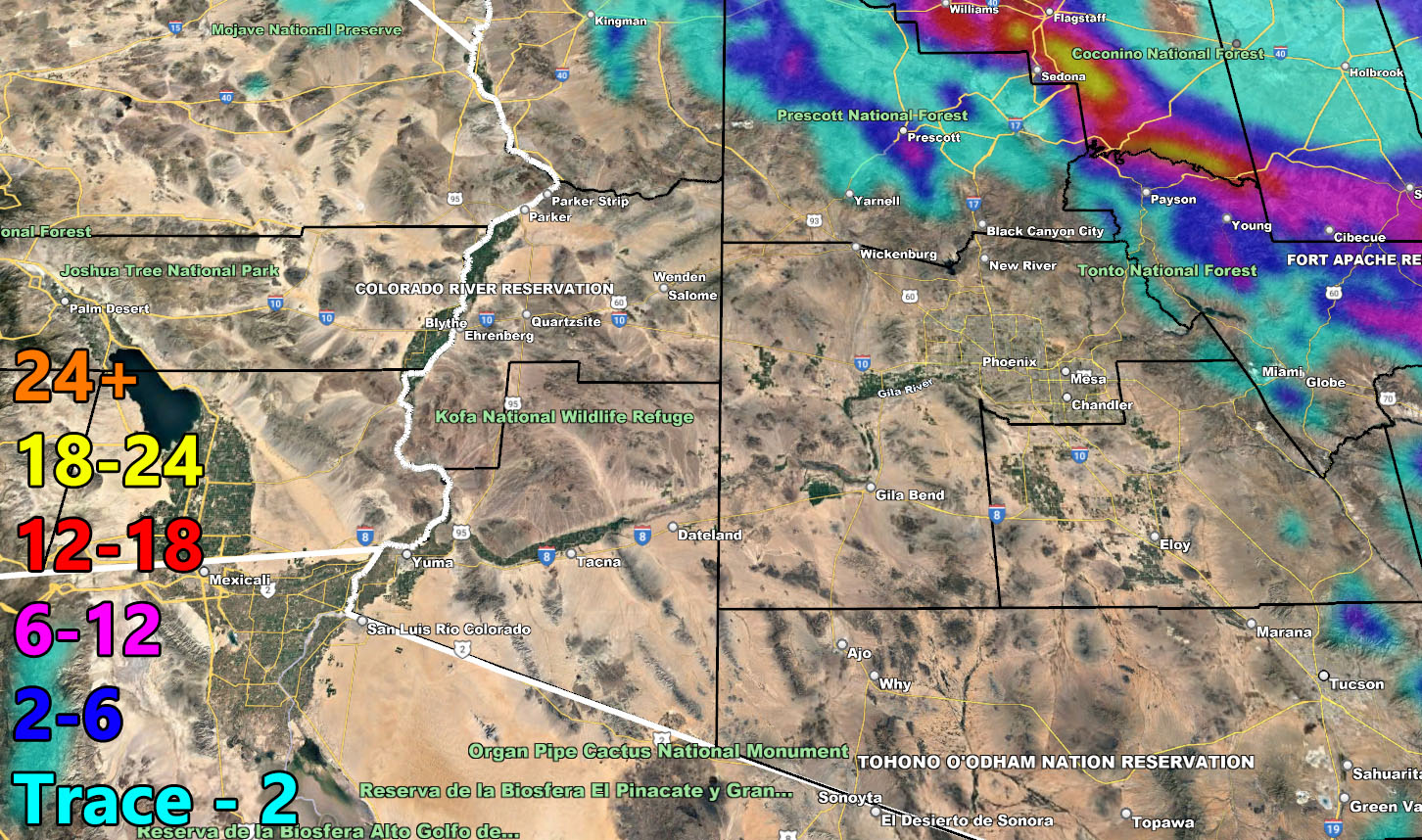
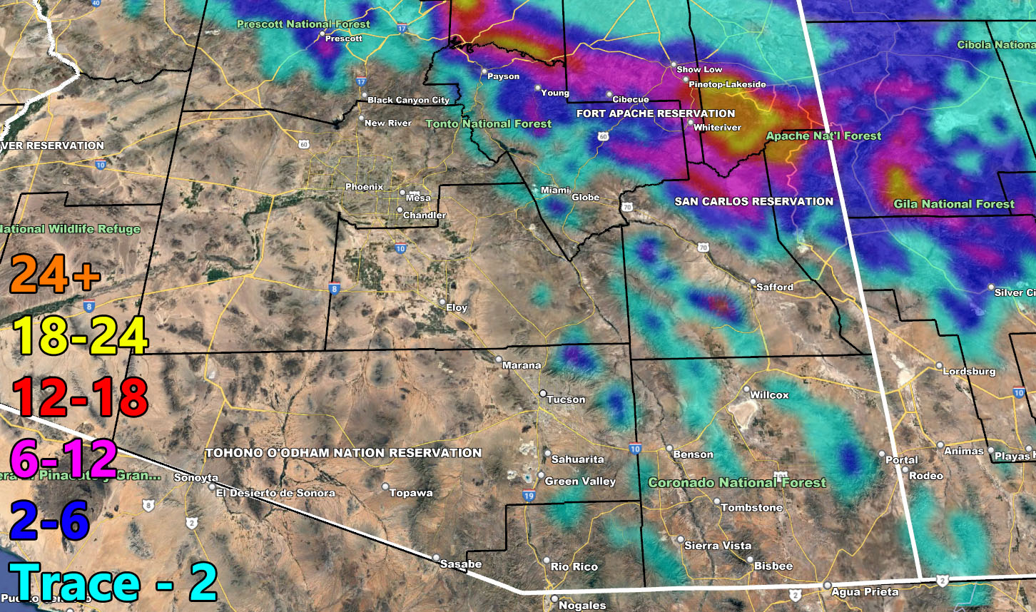
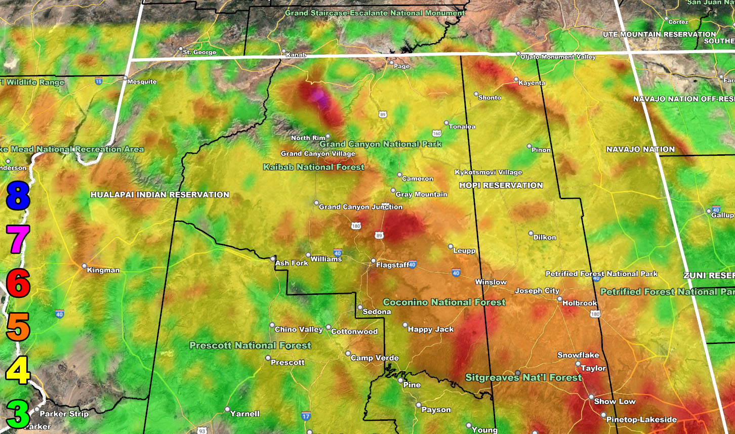
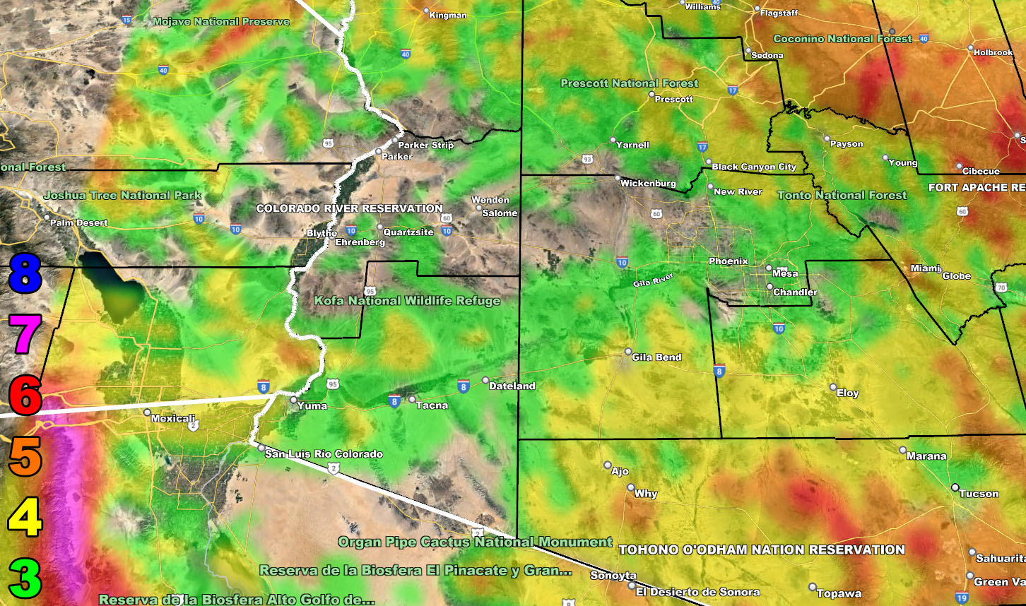
Not too much to say from the previous forecast with the exception of the chance of thunderstorms New Years Day for all metro areas, spanning from Flagstaff southward through the metros of Maricopa/Pinal/Pima County and areas surrounding there. Flagstaff will see 3-4″ of snow by noon on New Years, with the final tally of a foot of snow by the time the storm moves on out.
WANT THESE DELIVERED WITH ALL THOSE PERKS INCLUDING BEING ON THE MICRO-CLIMATE ALERT SYSTEM AND MODELS DURING EVENTS BECAUSE NOT EVERY ALERT IS POSTED ON SOCIAL MEDIA FROM THIS WEATHER OFFICE – JOIN TODAY BY CLICKING HERE – Arizona Weather Force Fundraiser and Subscriber System – Arizona Weather Force
Join the Facebook Page for Further Updates If You Have Not Yet!
ARIZONA WEATHER FORCE MAIN:
We will have another impulse later Monday night into the 3rd. This will be colder, so this is when Payson and Prescott see some snow, Payson would be 3-5″ mark and Prescott to 1-2″ mark.
LONG RANGE: More storms will be moving through during the month of January as we get into yet another storm pattern after a lull in activity after the current pattern. I will touch on that with the January 2023 forecast, expected to be released in a couple of days, but we will remain with my original forecast from months ago stating a wetter season, and we have seen that thus far. Click here to read that forecast.
The models image links below will be for rain, snow, and wind in the allotted time projected so use that for your area forecast.
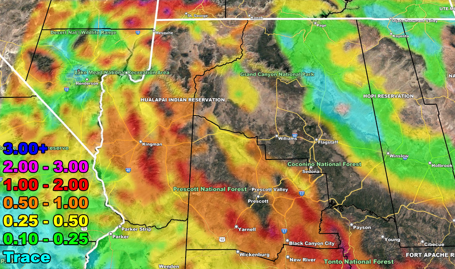
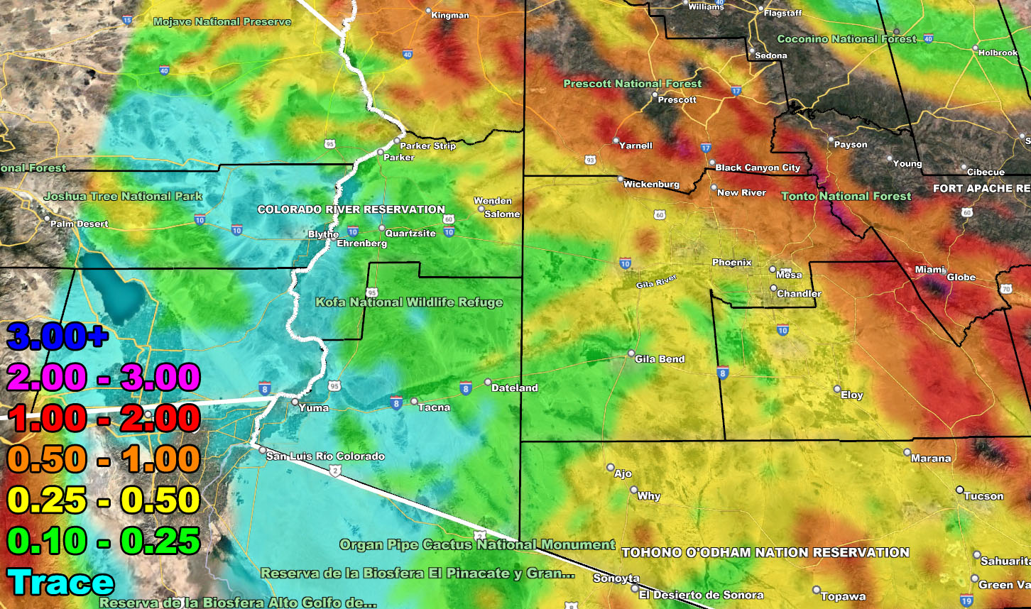
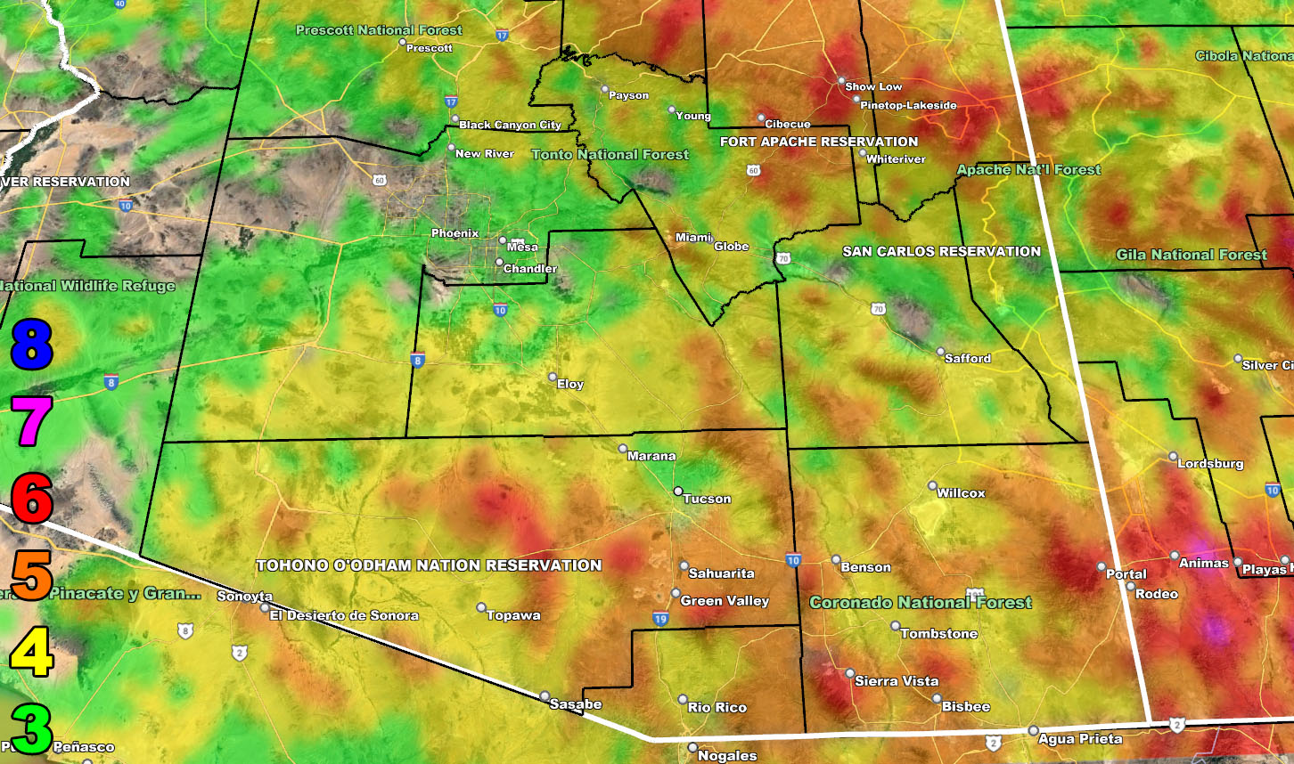
Rain Model – VALID NEW YEARS DAY INTO NEW YEARS NIGHT
SUPPORTING MEMBERS: Click Here To See The GPS Version Of This Model In Your Member Section Tab.


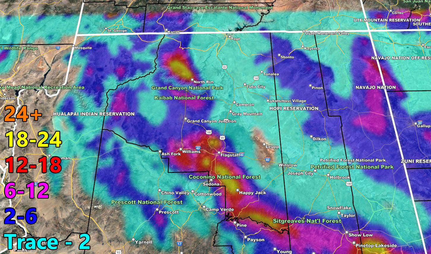
Snow Model – VALID NEW YEARS DAY INTO NEW YEARS NIGHT
SUPPORTING MEMBERS: Click Here To See The GPS Version Of This Model In Your Member Section Tab.

Wind Model – VALID NEW YEARS DAY INTO NEW YEARS NIGHT
SUPPORTING MEMBERS: Click Here To See The GPS Version Of This Model In Your Member Section Tab.
Raiden Storm Wind Gust Intensity Scale –
8. Extensive widespread damage.
7. Trees are broken or uprooted, building damage is considerable. – High Profile Vehicle Roll-Over CERTAIN.
6. SOME Trees are broken or uprooted, building damage is possible. – High Profile Vehicle Roll-Over Likely, Do NOT recommend Traveling in this zone. This zone also is the starting zone where trees and powerlines will fall and damage cars and even kill people near or in them!
5. Slight damage occurs to buildings, shingles are blown off of roofs. HIGH WIND WARNING CRITERIA – High Profile Vehicle Roll-Over Possible if weight is not corrected.
4. Twigs and small branches are broken from trees, walking is difficult.
3. Large trees sway, becoming difficult to walk. POWER SHUTDOWN THRESHOLD DURING FIRE WEATHER / WIND ADVISORY CRITERIA

WANT THESE DELIVERED WITH ALL THOSE PERKS INCLUDING BEING ON THE MICRO-CLIMATE ALERT SYSTEM AND MODELS DURING EVENTS BECAUSE NOT EVERY ALERT IS POSTED ON SOCIAL MEDIA FROM THIS WEATHER OFFICE – JOIN TODAY BY CLICKING HERE – Arizona Weather Force Fundraiser and Subscriber System – Arizona Weather Force
TWITTER: Join the AZWF Twitter For Articles By Clicking Here
Join The Main Arizona Weather Force Facebook Group (50 percent delivery time of micro-climate alerts not posted on the main AZWF page) – You can join the main AZWF page as well through that group.
Click Here To Join The Page Today