Arizona Mountains Show Low 6400
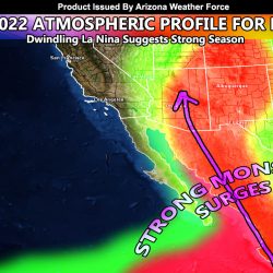
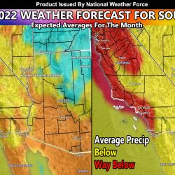
April 2022 Update: Southwestern United States Monsoon Forecast Update For Summer 2022
Storm System Moving Out Of Southern California To Bring Arizona Thunderstorms Through Tuesday; Rain and Snow Maps Inside
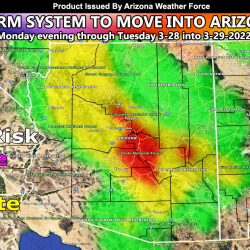
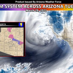
Storm System To Move Across Arizona Monday Evening Through Tuesday; First Outlook
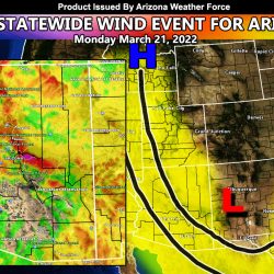
Near Statewide Wind Event Projected Across Arizona For Monday March 21, 2022; Details Maps Inside
Winter Weather Advisory
March 2022 Weather Pattern Forecast For The Southwestern United States; A Month Of Tease
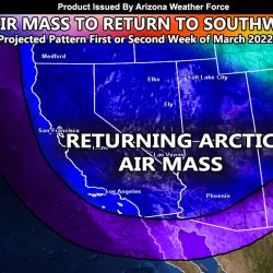
Warm Up Expected Across The Arizona Low Terrain Metros This Next Week Followed By A Return Of The Arctic Air Masses In March
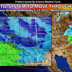
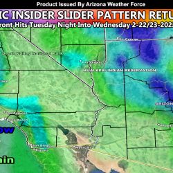
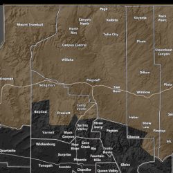
PRELIMINARY FORECAST: Arctic Inside Slider To Move Through Parts of Arizona Later Tuesday into Mostly Wednesday; Snow and Rain Models Released