Author: Weather
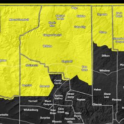
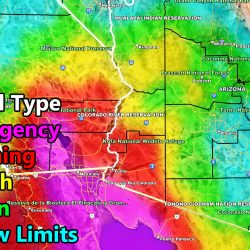
Flood Watch and Urban Flood Advisory Upgrade
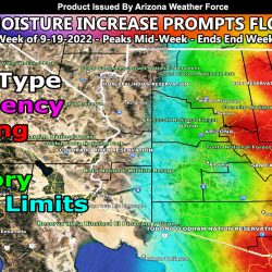
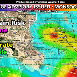
Increase In Tropical Moisture Prompts Flood Alerts To Be Issued For Metro Arizona and Mogollon Rim; Details For This Week
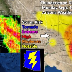
Enhanced Severe Thunderstorm Watch Issued For Southeast Arizona, Thunderstorm Watch for Mogollon Rim; Details and Maps Inside
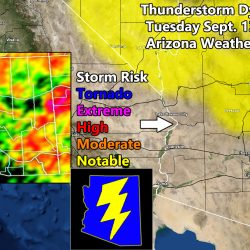
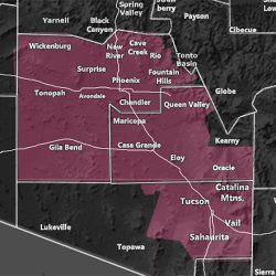
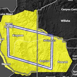
Severe Thunderstorm Watch Issued For Arizona Metro Zones and Mogollon Rim; Details and Maps Inside
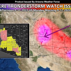
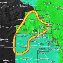
Severe Thunderstorm Watch Issued includes Tucson and Phoenix Metros; Enhanced To Parker/Havasu Through Tonight
Weather Advisory
Hurricane Kay: Two AZWF Flood Alerts Issued Across The Western half of Arizona
Severe Thunderstorm Watch